Project Name
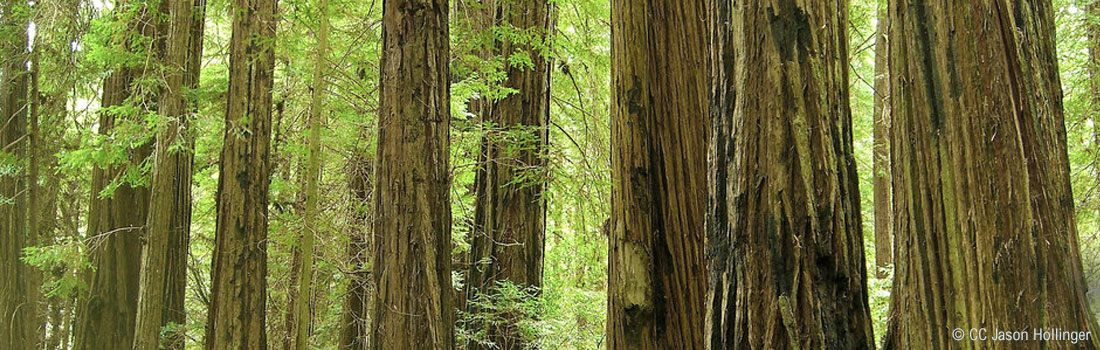
Redwoods Restoration
Preserving a redwood forest and improving visitor access
JANUARY 23, 2026
Redwoods, Water, and Wonder Storymap
The history of the preserve and the story of the preservation project is captured in this GIS Storymap: Redwoods, Water, and Wonder.
NOVEMBER 23, 2024
Loop and Boardwalk Trails Open
Work has been completed on the new Loop Trail and Boardwalk Trail. This area of Roy's Redwoods is now open to the public. Review the updated preserve map for more details. Monitoring of native plant restoration in the redwood understory will continue for years to come.
AUGUST 1, 2024
Trail Closures for Construction
Construction work resumed on July 1, 2024 on the Roy’s Redwoods Restoration Project. The entire Meadow Trail, and north of Loop Trail, is closed 24/7 while work is taking place. Adjacent areas, including social trails, will also be closed. Heavy equipment is in the area. For your safety, respect all closure signs.
JULY 1, 2023
Restoration Work Begins
The east end of Meadow Trail, and adjacent areas, including social trails, will be closed in Roy's Redwoods 24/7 during the first phase of construction, which will be taking place through fall 2023. The Fairy Tree will be accessible Friday to Sunday via the west end of Meadow Trail. Visitors should proceed with caution, respect closure signs, and be aware of heavy equipment in the area.
JUNE 13, 2023
Approved by Open Space District Board
On June 13, 2023, the Marin Open Space District Board approved moving forward with the Roy's Redwoods Restoration. Work will begin in August 2023 and continue until rainy season arrives in fall. Parks staff will begin to re-align trails outside the forest floodplain, decompact soils, and decommission undesignated trails. They will also begin carefully replanting sword ferns, the graceful, evergreen fronds that thrive in shady redwood habitat.
Work will resume in August of 2024. The goal is to complete construction and re-open the area to visitors in fall of that year. During this second phase of work, a large part of the preserve will be closed to the public. After the trails are open, planting and stewardship of the forest will continue for many years.
JUNE 2, 2023
Environmental Review Public Comment Period
The environmental review public comment period for the Roy's Redwoods restoration project took place February 6, 8:30 a.m. to March 10, 2023, 5:00 p.m.
The Marin County Open Space District will present the environmental document for certification by its Board of Directors at its regularly scheduled meeting on June 13, 2023. Should the Board of Directors certify the environmental document, it would consider approval of the proposed project at the same meeting.
The responses to comments document is available to review in advance of the Board of Directors meeting. See the Environmental Review tab for the link.
MARCH 31, 2020
Final Schematic Design
RDG Planning & Design provided the final schematic design for the Roy's Redwoods restoration project. The next step is environmental review, expected to begin in February 2023.
SEPTEMBER 3, 2019
Restoration Concepts
Community members met the design team and provided feedback on the initial concepts for Roy's Redwoods restoration.
The open community meeting took place at the San Geronimo Valley Community Center on Wednesday, July 31, 2019. As a member of the One Tam collaborative, Marin County Parks is exploring concepts that will:
- Restore the hydrologic function of the alluvial valley;
- Improve redwood forest and wetland habitats;
- Guide visitors through an immersive and accessible experience of the redwoods.
Project Description
Preserving a redwood forest and improving visitor access.
In the heart of San Geronimo Valley, Roy's Redwoods Preserve has a vital old-growth redwood forest habitat and offers visitors a unique immersive experience of these incredible trees. To better understand what makes Roy’s Redwoods special to the community, and the environmental challenges facing the preserve, Marin County Parks partnered with One Tam to complete a comprehensive analysis of the site[External]. This included:
- Talking with San Geronimo Valley community members
- Gathering expert knowledge of the site’s history and ecosystem
- A hydrologic assessment
- Vegetation and wildlife assessments
- Thorough review of existing literature and data on the site
- Citizen science events to document the biodiversity of the preserve
Preserving a redwood forest and improving visitor access
Funding
Roy's Redwoods Restoration funding totaled $3.7 million. Project implementation cost $3.5 million. The additional funds will go to monitoring and future site stewardship.
- California State Parks grant $1.5 million
- Wildlife Conservation Board grant $1.2 million
- Marin County Accessibility Program $500,000
- Parks Measure A $500,000
- One Tam philanthropic donations
Purpose
The purpose of the proposed project is to implement the MCOSD Road and Trail Management Plan (RTMP) to provide the public with a safe multi-use trail system to enhance the visitor experience, reduce the environmental impacts on sensitive resources by reducing sedimentation and erosion, and establish a sustainable system of roads and trails that meet design and management standards and would provide year-round access along the trail alignment. The project includes the following elements, which are summarized below and fully described in the Project Description section of the IS/MND.
Ecological and Hydrologic Restoration:
Reestablish a multi-threaded Stage Zero wetland-channel complex to reconnect Upper Larsen Creek to its surrounding floodplain, reduce erosion, restore hydrologic functions, and increase infiltration and raise the groundwater table, rehabilitate approximately 77,170 square feet of heavy visitor use areas throughout the valley floor to reduce soil compaction and increase conditions for natural regeneration of vegetation, halt development and persistence of incised channel reaches of Upper Larsen Creek through the valley floor using large and small wood structures, and re-orient existing fallen trees and downed branches and obtain and place additional logs, where needed, through the floodplain to improve natural hydrologic function by slowing and spreading water throughout the floodplain to allow flows to infiltrate into the soil.
Trail Improvements:
Upgrade and realign approximately 5,670 feet if existing trails to improve drainage, prevent future erosion and sedimentation, meet RTMP trail design standards and upgrade approximately 1,900 feet of existing trails to meet Marin County Parks Inclusive Access Plan standards for an Access and Discovery Trail.
Parking and Entryway Improvements:
Develop two new designated entryways and improve the existing entryway adjacent to Nicasio Valley Road, relocate the existing porta-toilet out of the floodplain and closer to the existing entryway, install one inclusive parking spot on the shoulder of Nicasio Valley Road, and reinstall fencing along the Nicasio Valley Road shoulder.
Social Trail Decommissioning:
Decommission approximately 6,465 feet of existing social trails located in sensitive areas using passive trail closure methods and active methods that involve heavy equipment and hand tools.
Visitor Education:
Install new fencing and visitor information signage to notify visitors of closed trails and discourage development of new social trails, construct a Nature Exploration Area and Scramble, provide visitor interpretive services and wayfinding signage.
Summary of Potential Impacts and Mitigation Measures:
The IS/MND identified potentially significant environmental impacts in the areas of Biological Resources and Transportation. Mitigation measures to reduce the significance of these impacts to a less-than-significant level is included in the IS/MND. The IS/MND concludes that, with implementation of the mitigation measures, the proposed project would not result significant environmental impacts.
Objectives
Implementation of the proposed project would achieve the following project objectives:
- Restore and enhance the health and resiliency of the redwood forest by restoring healthy soil conditions through decompaction of social trails and heavy visitor use areas, re-establishing a diverse forest understory plant community, and reducing impacts to wildlife habitat and the forest ecosystem by limiting the number and distribution of trails through the forest.
- Restore and enhance hydrologic process and function by stopping the development and persistence of incised channels through the alluvial valley floor, re-establishing a multi-threaded and dynamic wetland-channel network that is closely connected to the floodplain, storing a majority of the total sediment delivered to the valley floor on-site, and reducing winter peak flows and increasing the volume and longevity of spring and summer low flows.
- Improve the public access by providing an immersive visitor experience that is consistent with restoration goals, providing safe and sustainable year-round access to the bay and redwood forest portion of the Roy's Redwoods Open Space Preserve, improving access consistent with MCOSD’s Inclusive Access Plan, and providing visitor interpretive services.
Project Development
Planning and Site Assessment, Site Analysis Technical Memo
In 2014 a Memorandum of Understanding establishing the One Tam partnership, formerly known as the Tamalpais Land Collaborative, was signed by the four land management agencies charged with stewarding Mt. Tamalpais including the National Park Service, California Department of Parks and Recreation, Marin Municipal Water District, MCOSD, along with the Golden Gate National Parks Conservancy (Parks Conservancy). Through a prioritization process, One Tam established a list of priority projects that the partners would collaboratively undertake which included the proposed Roy’s Redwoods Restoration Project with the goals of protecting the diverse biological resources of the site, improving hydrologic function, preserving the rich history of the landscape, and providing access and amenities for visitors to enjoy Roy’s Redwoods into the future. Since the spring of 2017, the Parks Conservancy and the MCOSD have led a multi-agency team through scoping and project design.
Marin County Parks and Parks Conservancy staff assessed the area between 2017 and 2018 and presented recommendations in the Roy’s Redwoods Open Space Preserve Site Analysis Technical Memo November 2018. The technical memo includes descriptions of the bio-physical site characteristics and the historical, cultural, and recreational planning context. It also includes the results of a visitor use survey, a literature review, a series of technical workshops, site inventory and mapping, and community engagement. This early project planning phase helped to ground the project in the best available science, and gain understanding of community values and visitor use.
Through this site analysis process, the project team defined “Restoration of Roy’s Redwoods” to more specifically mean restoring the degraded hydrologic function of the alluvial valley and habitat of the old growth redwood forest. Key to this understanding was the hydrologic assessment conducted by Prunuske Chatham, Inc that detailed the degraded conditions and opportunities for improvements to hydrologic processes and function . In addition to the visitor experience benefit, the site analysis process helped confirm that providing a comprehensible trail circulation system through the redwood stand would be a critical element to successful restoration.
Subject Matter Experts Workshop
The MCOSD and One Tam hosted a subject matter expert workshop to develop an initial site inventory, identify opportunities and constraints, and provide guidance to the project team on areas to focus further study. The workshop was held on May 9, 2017 and included staff from private organizations, local, state, and federal agencies. A primary outcome of the meeting was identification of the need to understand the hydrology of upper Larsen Creek and its relationship to important habitat downstream and identification of hydrologic restoration opportunities.
Tribal Consultation
The MCOSD staff provided notification of the proposed project to the Federated Indians of Graton Rancheria (FIGR), the Guidiville Indian Rancheria (GIR), and the Coast Miwok Tribal Council of Marin (CMTCM) on July 19, 2021 and asked if a consultation process pursuant to California Assembly Bill 52 should be initiated. FIGR provided an email confirming receipt of this notification but no further comments and did not respond to the MCOSD’s request to meet. The GIR did not respond. The CMTCM provided a response including a formal AB52 request from our Tribal Council designating a contact person to consult on the proposed project but did not follow up with the MCOSD’s request to meet.
Timeline
- March 2017: Community Biolblitz
- November 2017: Community Walk & Talk
- May 2017-March 2018: Visitor Surveys
- May 2018: Community Field Day Workshop
- August 2018: Second Community Workshop
- October 2018: Draft Site Analysis Technical Memo
- 2019: Conceptual Designs
- 2020: Design Refinement
- 2021: Prepare Draft CEQA Document
- February 06 – March 10, 2023: Public Review Period of the CEQA Document
Preserving a redwood forest and improving visitor access
JUNE 2, 2023
Response to Public Comments
The MCOSD presented the Roy’s Redwoods Restoration Project IS/MND to its Board of Directors for certification, along with project approval, at their regular meeting on June 13, 2023. All comments received on the IS/MND and MCOSD's responses were included in the material provided to the Board of Directors for their consideration.
- Response to Public Comments
- Revised Initial Study/Mitigated Negative Declaration
- Mitigation Monitoring and Report Plan
FEBRUARY 6, 2023
CEQA Public Comment Period
The Marin Open Space District (MCOSD) prepared a draft Initial Study/Mitigated Negative Declaration (IS/MND) for the proposed Roy’s Redwoods Restoration Project. The IS/MND provides information regarding the setting of the project area, the project description, analysis of potentially significant environmental impacts that could result from implementation of the proposed project, and mitigation measures to reduce potentially significant environmental impacts to a less than significant level. The IS/MND identified potentially significant environmental impacts in the areas of Biological Resources and Transportation. Mitigation measures to reduce the significance of these impacts to a less-than-significant level is included in the IS/MND. The IS/MND concludes that, with implementation of the mitigation measures, the proposed project would not result significant environmental impacts.
- Notice of Intent to Adopt a Mitigated Negative Declaration
- Draft Initial Study/Mitigated Negative Declaration
The public comment period took place February 6, 8:30 a.m. to March 10, 2023, 5:00 p.m.
Preserving a redwood forest and improving visitor access
Community Meetings
The MCOSD conducted a number of public information meetings, workshops, and field walks between March 2017 and November 2020. The primary purpose of these meetings was to inform stakeholders about project concepts to improve public access and restored the hydrologic function of the valley floor through the redwood forest and to collect public input about the project.
Neighborhood Outreach
The MCOSD and the Parks Conservancy presented the project to the San Geronimo Planning Group on May 12, 2022 with a follow-up site visit a couple weeks later. MCOSD presented the proposed project to the Marin Conservation League in October 2022.
The MCOSD and the Parks Conservancy made presentations about the project to the San Geronimo Valley Stewards and the French Ranch Home Owners Association on November 9, 2020 and December 2, 2020 respectively. The meeting involved discussions regarding the recent increase in visitation, visitor use impacts, and parking. Discussions also included restroom limitations, groundwater and streamflow data collection, construction impacts, and funding.
The MCOSD met with local environmental educators on November 11, 2019 to discuss the plans and to collect feedback.
Stakeholder Workshop
The MCOSD and One Tam held a stakeholder workshop on August 2, 2017 to introduce the project and project goals, share work completed to date, and to gather additional knowledge of the site. Participants were asked to contribute knowledge and ideas regarding biological resources, visitor circulation, visitor experience, and visitor uses. This workshop confirmed that resource protection, habitat restoration, and an improved visitor experience was desired by stakeholders. Along with identifying key visitor destinations, the workshop established that the lack of a formal trail system is understood to be detrimental to biological resources but also degrades the visitor experience. Participants expressed the importance of retaining access to Roy’s Redwoods for local schools and environmental education opportunities.
Bioblitz 2017
On March 25, 2017, 23 volunteers of all ages came to the Roy’s Redwoods Open Space Preserve for the first One Tam Bioblitz of 2017. Along with staff and interns from the MCOSD, the Parks Conservancy, and the Marin Municipal Water District, the group divided into teams to survey four areas including grasslands, meadow, redwood forest, and mixed evergreen forest.
Roy's Redwoods Walk & Talk with Jean Berensmeier
On November 4, 2017, staff from the MCOSD and the Parks Conservancy teamed up with Jean Berensmeier to lead a site visit and short hike at Roy’s Redwoods Open Space Preserve. The project team introduced the effort to study restoration and visitor experience improvement opportunities at Roy’s Redwoods Open Space Preserve.
Roy's Redwoods Field Day
On May 12, 2018, staff from the MCOSD and the Parks Conservancy hosted an on-site workshop which was advertised to the community. Approximately 30 community members attended the event. The project team discussed the project, presented the findings of the visitor use survey and site-analysis to date, and engaged the attendees in conversation about the project, knowledge of the site, and ideas for enhancement. A hydrologist from Prunuske Chatham, Inc. also presented preliminary findings of the hydrology study and impacts to the hydrologic function from visitor use. Finally, a National Park Service interpretive ranger and naturalist led the group on a walk through a portion of the redwood grove identifying natural resources present and discussed challenges with balancing resource protection and visitor experience of the redwoods.
Feedback was solicited informally from the attendees by the project team throughout the day. A consensus was heard with support for a project that restored the hydrologic function of the site, improved protection of the biological resources, and enhanced the visitor experience of the redwood forest while minimizing visitor impacts.
Community and Public Meetings
The MCOSD and the Parks Conservancy hosted a community meeting on July 31, 2019 to present the draft concept plan to interested members of the public. The project team introduced ideas for restoring the hydrologic function of the alluvial valley, improving redwood forest and wetland habitats, and guiding visitors through the immersive and inclusive access experience of the redwoods. The meeting was designed to gather feedback on initial project concepts. One Tam followed up with emails to the project stakeholder and community email list to provide a draft project map and a link to the information presented at the community meeting. One Tam distributed the email on August 7, 2019.
Environmental Roundtable Meetings
The Environmental Roundtable is a forum facilitated by the MCOSD and includes two representatives from each of the following environmental organizations: California Native Plant Society, Sierra Club, Friends of Corte Madera Creek, Marin Conservation League, Environmental Forum of Marin, and Marin Audubon Society. The purpose of the Environmental Roundtable is to facilitate a natural resource focused discussion and exchange of ideas between the MCOSD and members of the community as it relates to natural resources management and project development. The proposed project has been presented at Environmental Roundtable meetings regularly between 2019 and 2022.
Marin County Parks and Open Space Commission
The Marin County Parks and Open Space Commission advises the Marin County Board of Supervisors regarding parks and open space policy and conducts public hearings on parks and open space matters considered for recommendation to the Board when appropriate. There are seven members appointed by the Board of Supervisors, each having demonstrated expertise and interest in subject areas and disciplines beneficial to the county's provision of parks and open space stewardship, facilities, programs, and services. The MCOSD staff presented the proposed project to the Marin County Parks and Open Space Commission on September 19, 2019, and September 15th, 2022.
Marin Project Coordination Meetings
Marin Countywide Stormwater Pollution Prevention Program holds monthly project coordination meetings designed to review and guide projects through the environmental and regulatory permit process. These meetings are intended to provide a forum for interaction and input, not public comment or regulatory action. The MCOSD presented the proposed project at a Marin Project Coordination meeting on May 2, 2019 and hosted a site visit for regulatory agency staff on June 3, 2019 to provide the participants with information on the project and project background. The MCOSD also presented the Stage 0 hydrologic restoration concept on February 6, 2020.
Region 2 Designation
Roy’s Redwoods Open Space Preserve is located within Region 2. The road and trail designation for Region 2 occurred in late 2015. The Region 2 Designation Workshop was held on October 3, 2015. Following the workshop, the public had an opportunity to view and comment on the proposed road and trail system for Region 2.