
Project Name
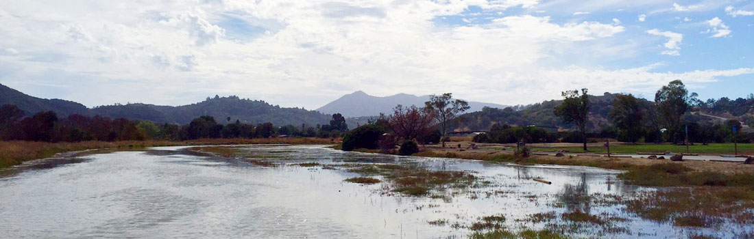
McInnis Marsh Restoration
Reclaiming historic tidelands and protecting against sea level rise
JUNE 16, 2025
Marin County Parks and CSA #6 (Gallinas Creek) remain committed to working together on wetland restoration at McInnis Marsh. This includes beneficial reuse of sediment from the proposed South Fork Gallinas Creek dredging.
A Technical Challenge
The McInnis Marsh project proposal has evolved, due to technical challenges with a Gallinas Valley Sanitary District main line. A pipeline carrying treated wastewater runs beneath the McInnis Marsh main basin. In 2022, geotechnical analysis showed that an ecotone levee, part of the original project proposal, could have a negative impact on this force main pipeline.
Several alternatives were studied, but none were feasible. To protect the sanitary district pipeline, the proposed project has been re-envisioned. The proposed project now encompasses components that are under the exclusive management and ownership of Marin County.
Multiple Benefits
Geomorphic dredging of Gallinas Creek would significantly improve low-tide small boat access to the creek channel. This would improve recreational navigation for small public watercrafts on the south fork of Gallinas Creek. Reuse of the dredging material would raise elevations of the subsided marsh to facilitate wetland restoration goals.
- Beneficial re-use of geomorphic dredge material
- Meaningful near-term tidal marsh restoration
- Resilient trail access
- Allows for future potential larger-scale restoration
- No increased flood risk to surrounding communities
Features of the Proposed Project
Geomorphic dredging of Gallinas Creek would significantly improve low-tide small boat access to the creek channel. This would improve recreational navigation for small public watercrafts on the south fork of Gallinas Creek. Reuse of the dredging material would raise elevations of the subsided marsh to facilitate wetland restoration goals.
- Beneficial re-use of 100,000 cubic yards of dredge sediment from the geomorphic dredging of the south fork of Gallinas Creek
- Create transitional uplands within 30-acres of tidal marsh in southern McInnis Marsh, consisting of the pencil and tail sections, achieved by breaching the perimeter berms and constructing a new tidal channel through these two basins
- Contribute to the recovery and resiliency of the 140-acre main basin at McInnis by placing dredge sediment to increase elevations by 0.5 to one foot and increasing the grade to an elevation that could support future potential tidal marsh habitat restoration
- Improve access to the San Francisco Bay Trail by creating a uniform 10-foot-wide trail, consisting of an 8-foot-wide trail and one-foot-wide shoulders on each side
- Realign the San Francisco Bay Trail to accommodate the proposed project which would include and 0.4-mile gap along the east side of south McInnis Marsh
- Improve the quality of tidal marsh and non-tidal wetland habitats adjacent to the trail network, improving the experience for trail users
Special Status Species
Wetland restoration could potentially benefit several special status species.
Birds and Mammals
- Ridgway’s rails (Rallus obsoletus)
- California black rails (Laterallus jamaicensis coturniculus)
- burrowing owl (Athene cunicularia)
- salt marsh harvest mouse (Reithrodontomys raviventris)
- American badger (Taxidea taxus)
- Marine Mammal Protection Act protected pinnipeds
Fish
- Central California Coast steelhead (Oncorhynchus mykiss irideus)
- Central California Coast coho (Oncorhynchus kisutch)
- green sturgeon (Acipenser medirostris)
- white sturgeon (Acipenser transmontanus)
- longfin smelt (Spirinchus thaleichthys)
- Pacific lamprey (Entosphenus tridentatus)
Plants
- Point Reyes bird’s beak (Codylanthus maritimus ssp. palustris)
- white seaside tarplant (Hemizonia congesta ssp. Congesta)
- California sea blite (Suaeda californica)
- Palmer’s Frankenia (Frankenia palmeri)
- Marin knotweed (Polygonum marinense)
Reclaiming historic tidelands and protecting against sea level rise
McInnis Marsh lies within the historic confluence of Las Gallinas and Miller Creeks. During periods of flood and high tide, these creeks once flowed unimpeded through a network of tidal wetlands, converging in the Gallinas Baylands.
Historically, Miller Creek flowed into delta network that spread over a broad swath of bay margin. When Miller Creek flooded, water flowed south to Gallinas Creek. This connectivity was lost in the early 1900’s when levees were constructed, confining Miller Creek to a narrow 150-foot wide channel flowing to San Pablo Bay.
The property was acquired by Marin County in 1972, and developed for park use. McInnis Marsh is currently an undeveloped area within the park. The public currently enjoys hiking, biking, and dog walking on the levee top trails on the perimeter of the marsh.
Marin County Parks is the lead agency for the McInnis Marsh Restoration Project. Since 2012, the following agencies have participated in the study of potential restoration actions.
- California Department of Fish and Wildlife
- California State Coastal Conservancy
- Las Gallinas Valley Sanitary District